El Niño is probably back—here’s what that means
Are you prepared for a wet, hot El Niño summer?

This year is going to be pretty unforgettable, and not in a good way. Climate scientists have predicted the arrival of El Niño, a climate pattern that temporarily warms up waters in the eastern Pacific Ocean and will change precipitation and temperature patterns around the world.. The last El Niño event took place from 2018 to 2019.
Each El Niño is unique in terms of how intense the warming effect gets, says Daniel Swain, a climate scientist at UCLA. This makes it harder for individual areas along the Pacific, like California and countries in Southeast Asia, to know how to properly prepare for upcoming storms or flooding.
Past El Niño events can help areas get a broad sense of how strong the next one will be, but as time goes on, Swain says it is likely we will see an increase in extreme El Niño events because of climate change. This upcoming one is expected to make 2023 the hottest year in human history.
What is the forecast for El Niño 2023?
Climate scientists use a variety of tools to predict when and how hard El Niño will hit. Some examples include satellites to track wind and tropical rainfall patterns, ocean buoys to monitor sea surface temperatures, and mini radios strapped to weather balloons that measure air temperature, humidity, and pressure.
David DeWitt, director of the Climate Prediction Center at the National Oceanic and Atmospheric Administration, forecasts an 82 percent chance of El Niño arriving between May and July. A weak El Niño is not out of the question, but the likelihood of a strong El Niño is about 55 percent. There’s also a 90 percent chance of El Niño persisting in the first few months of 2024.
How does El Niño warm the ocean?
During El Niño, weak winds coming from the east cause heat to build up along the equator in the eastern Pacific Ocean. As the waters warm up, they transfer heat to the atmosphere and create moisture-rich air that fuels rainstorms and floods.
One sign of an upcoming El Niño event to look out for is Kelvin waves in the Pacific. These aren’t your normal beach waves: They resemble the slow sloshing ones in your bathtub. The long movements pull expanding warm water to the ocean’s surface, which in turn, raises sea levels. They also strengthen El Niño by further reducing how much cold water is on the ocean’s surface.
[Related: The jet stream is moving north. Here’s what that means for you.]
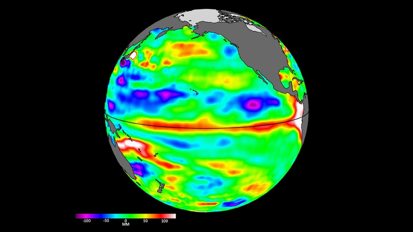
Recently, satellites orbiting Earth detected two- to four-inch-high Kelvin waves moving west to east along the equator. They also measured higher than average sea levels—another strong clue for El Niño. “If it’s a big one, the globe will see record warming,” NASA scientist Josh Willis said in a statement.
How will El Niño affect global weather patterns?
Brad Rippey, a meteorologist for the US Department of Agriculture, says El Niño is expected to cause flooding in some regions and droughts in others. During the Northern Hemisphere summer (June to August), El Niño will likely suppress Atlantic hurricanes and bring drought in regions such as Central America, the Caribbean Basin, and southern and southeastern Asia. During the Southern Hemisphere summer (December to February), areas like southern Africa, Australia, and the western Pacific Basin will experience more heat, droughts, and fires.
Some regions of the world, however, will face wetter conditions. Rippey says that parts of South America, such as Argentina, have been reeling from drought because of the long-running La Niña that began in 2020. With El Niño, these areas would finally get doused with precipitation.
Is climate change making El Niño worse?
El Niño and its cooler counterpart La Niña are part of a natural cycle between warming and cooling of the Pacific Ocean that was first detected by South American fisherman in the 17th century. That said, climate change is interacting with this cycle and shaping a future with stronger El Niño episodes. “The Earth’s natural climate cycle and climate caused by humans are not independent of each other,” Swain explains. He adds that before global warming, the world’s temperature would reset after El Niño, but now it remains elevated.
The combination of human-caused global warming and short-term warming from El Niño could mean that the second half of 2023 or early 2024 will break global temperature records, Swain says.
Is the world prepared for the switch from La Niña to El Niño?
Yes and no. While most communities have experienced the upturns and downturns of El Niño before, each cycle is different. This upcoming one is no exception.
The level of preparation depends on the country and whether El Niño will trigger more heatwaves or flooding. Another factor is a country’s economy and whether they can afford to invest in protective measures.
[Related: This summer could push US energy grids to their limits]
“It’s usually the places that are most vulnerable that often have the least ability to shift things around to prepare,” says Swain. The 2015-2016 El Niño event, for example, caused heat stress, malnutrition, and disease outbreaks for more than 60 million people living in developing countries. But that doesn’t mean richer countries come out unscathed. For instance, El Niño events in the past 15 years cost the US economy $25 billion. A study published on May 18 in the journal Science estimates the average El Niño cost the global economy $3.4 trillion.
Being a few months away, Swain says it’s unlikely that a resource-poor region can change things around in a short time. “Now the question becomes, how much resilience do these places have to these kinds of natural hazards?”